
UP42 has had an interesting journey since our founding in 2019, and 2022 was especially exciting. But before we dive into those updates, let’s start with a short introduction. UP42 is a platform and marketplace that provides API-first access to a wide range of geospatial data and analytics. We’re on a mission to simplify access to satellite imagery, expand the earth observation market, and make it easier than ever to access data and extract insights at scale.
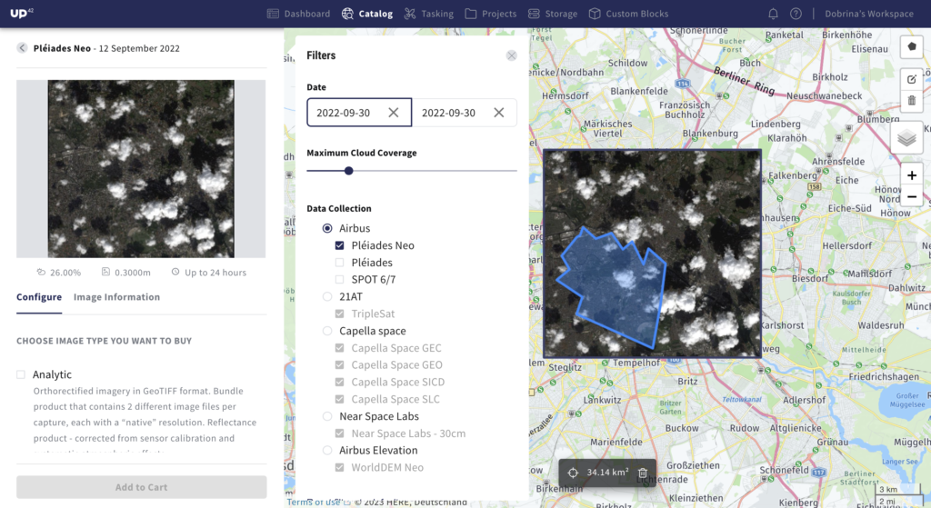
With this in mind, we launched the UP42 data platform, a one-stop-shop for all geospatial data needs, to overcome the challenges of ordering data from different providers. The UP42 catalog hosts archive data from providers such as Airbus, Capella Space, 21AT, Near Space Labs, and more. We’ve got optical, radar, and elevation data integrated into our platform. Here’s why this matters:
● Instead of contacting or setting up accounts with a range of providers, which often means different compliance and maintenance needs, multiple contracts, and integrations, our users get one single interface (available via API, SDK, or console). Here, users can search for and order data, get price estimates and updates, and download their data, independent from data host capabilities.
● Users can also activate automated status updates with webhooks, saving further time and effort.
● The best part is: image previews are available for all products, and real-time requests in the catalog show which products are immediately available.
It’s easy. Customers simply define order parameters (AOI, certain cloud coverage, start/end date) and integrate all the products they need. The same set of parameters
applies to all providers in an order, so adding a new product takes about 3 seconds: just enter the data product ID and the ID of the image needed for the order. This is especially important for projects that need a highly customized solution and a combination of different temporal, spectral, and spatial resolutions. Complete projects on time and within budget, further benefiting from an AOI-based pay-as-you-grow pricing model, with no volume commitments.
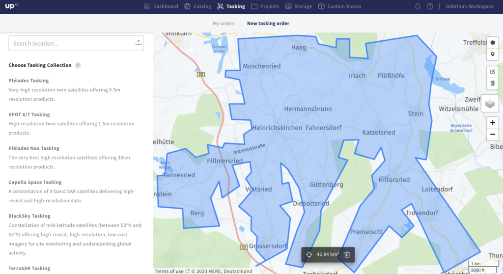
And if a user can’t find the right archive data, they can task a satellite to capture the area needed. This gives the freedom to define exact parameters, collect the perfect image, and support informed decision-making. Last year, we introduced our streamlined tasking interface and brought all tasking actions together in one place. Whether placing a new tasking order or monitoring an existing request, the whole tasking process can now be managed within the platform. Below, we’ve broken down the tasking process into steps.
● Place an order: choose a collection, draw an AOI, fill out the form, and submit ● View order status: view order AOI, status, and pending actions
● Review feasibility: when the feasibility study is ready, review and choose from the options
● Pay and activate: view and confirm the price to pay and activate the order ● Track progress and download your assets: when assets are ready, download directly from order details
The UP42 tasking platform gives direct access to satellites from Airbus, Capella Space, ICEYE, and BlackSky, so users can benefit from different types of data and resolutions.
We’re always ready to process urgent requests. When dealing with budget constraints and a tight window, or simply needing to task satellites from different providers, UP42 can help.
Data is also available for integration with other ecosystems, such as QGIS or Esri. Existing Esri users can immediately access UP42 storage and projects directly from their ArcGIS Pro account.
And what does 2023 hold for us? Expect even more providers on our data and tasking platforms with Head Aerospace, Hexagon, and Satellogic, to name just a few. We’ll also be introducing an even better discovery experience on our catalog, along with multiple AOI support for tasking, STAC & one set of common geospatial metadata, processing capabilities for ARD, and much more.