
More and more often we see satellite images on media around the world. This is because they offer a clear and honest vision of the Earth to understand and observe events such as climate change, drought, floods, temperatures, volcanic activity.
Social media has accustomed us to sharing and re-sharing photos and videos, making some places suddenly famous because they are 'instagrammable', can be replicated form anyone with some “special filter” to make each picture unique. Earth Observation satellite images have become equally acceptable in recent years, but maintaining a natural 'objectivity'.
MEEO developed the ADAM platform to facilitate accessing a large amount of geospatial environmental data. Besides traditional commercial land scientific applications, ADAM turned to be the optimal tool to speed up the creation of media contents: satellite images, pollution information, climate data and trends can be easily extracted, elaborated within the platform and distributed to the media.
From remote sensing expertise to communication, MEEO started the activity of ADAM in the social media world with a small internal team: from 2018 to now the satellite images have travelled from Twitter, Instagram, Facebook, LinkedIn and recently also Mastodon.
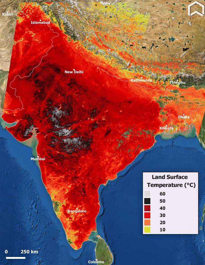
(heatwave in India and Pakistan (April, 29th 2022)
As seen by Copernicus Sentinel3 LST (Land Surface Temperature). The tweet got more than 6 Millions of Impressions and 118 K of Engagements. This image was used by climate activists, political personalities and a lot of media all over the World (ex. The Washington Post).
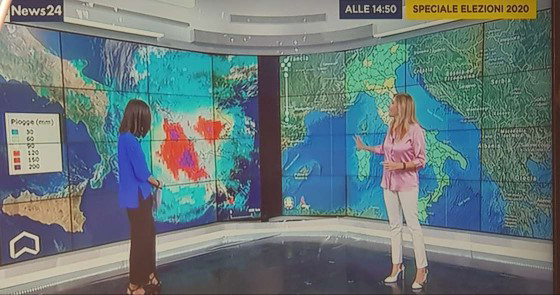
From the web to the classic media (Newspaper and Television Broadcast) the step is short!
In 2020 MEEO started a collaboration with the Italian National Broadcast RAI: since then a lot of satellite images have entered in the Italian’s houses. With different communication guidelines, contents are created for the regular weather reporting (in close cooperation with the RAI Meteo team), but also to explain phenomena such as volcanic eruptions, extreme events, drought, climate change, coastal erosion. It’s great to see how many common people can understand and are able to interpret satellite images that until few years ago were only pertinent to the scientific community. The use of Adam's images in the children's section of the television program ‘Green Meteo’, broadcast on RaiGulp, was a great success.
This growing communication activity of MEEO is made up of constant comparison, research and study. Performance results of the social media accounts are rewarding, as well as seeing the use of the products by the scientific community and the approach and growing interest by the general public, also by the children.
ADAM is the optimal link between the large amount of data generated every day by Copernicus, ESA and NASA, and the media community.
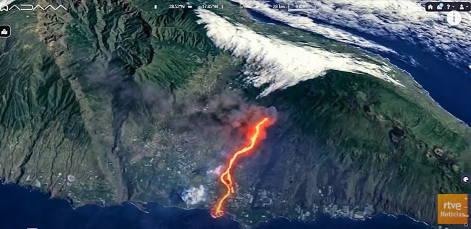
( 3D view of the La Palma volcano - Sentinel-2 image true color enhanced with short wave infrared channel, September 30th 2021)