
The Canal Seine Nord Europe stands as a monumental testament to modern engineering, arguably the most significant civil engineering project in Europe this century. With its vast scale, the project encompasses a decade of work, stretches over 100 kilometers, and involves the excavation of more than 70 million cubic meters of soil. Yet its ambitions go beyond mere construction; it aims to transform goods transportation in Europe, promising to divert approximately 5 million trucks from the roads annually, significantly reducing carbon emissions and traffic congestion.
This initiative aligns with contemporary environmental goals, marking a bold step forward in an era committed to curbing global warming and protecting biodiversity. By bridging the fluvial networks of Northern Europe with the Seine Maritime, it paves the way for more sustainable goods transportation across the continent.
The project has garnered support from the French Region Haut de France, French government, and the European Union, all demanding regular updates on progress and environmental impact. However, the project’s sheer scale challenges traditional monitoring methods, such as drones, which fall short in providing the needed comprehensive data.
Disaitek approached in mid-2022 to pioneer a satellite-derived data solution. After a year of rigorous discussion and negotiation, Disaitek was entrusted with an experimental contract to oversee the project’s progress and its environmental footprint. Our commitment spans three critical areas:
- Work Progress Monitoring: We ensure meticulous measurement and traceability for excavated soils and oversee the construction progress of roads and fluvial locks and ancillary works.
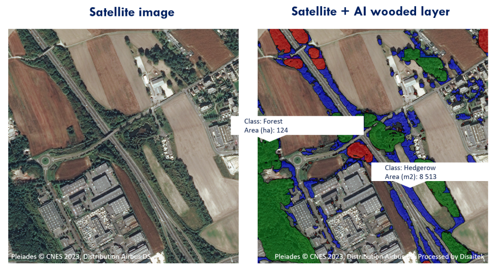
- Environmental Impact Assessment: Our high-precision mapping technology tracks vegetation and supports a nature-based compensation program, alongside automated crop identification.
- Encroachment Detection: We vigilantly monitor operational boundary exceedances, illegal land use, and road deterioration.
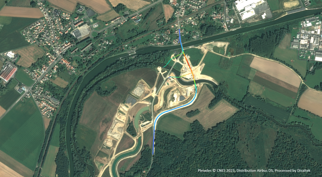
We task the Pléaides satellite on a monthly basis, both mono and stéréo depending on location and use cases, to provide detailed imagery to feed our algorithms and AI models, achieving remarkable success in our objectives. Our GIS-based platform offers stakeholders easy access to a wealth of analyses across these domains.
As our experimental phase nears completion, we stand on the brink of negotiations to establish our platform as the project’s monitoring tool during its construction and exploitation phases.